

Key Insights
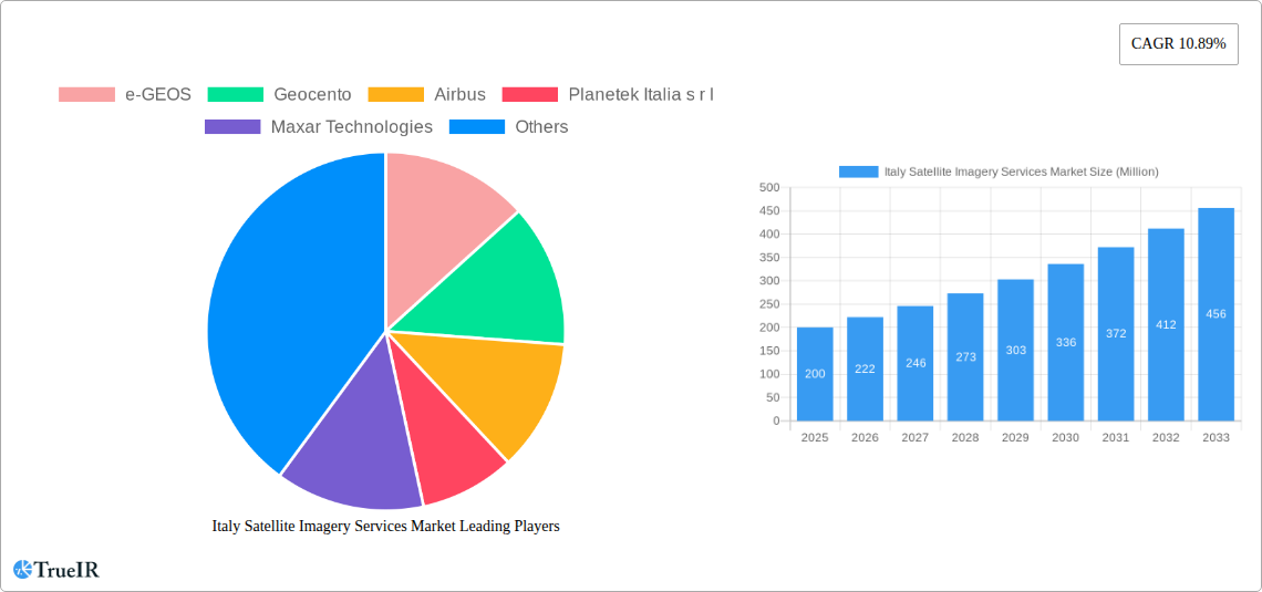
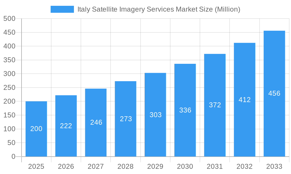
The Italian satellite imagery services market, valued at approximately €200 million in 2025, is projected to experience robust growth, exhibiting a compound annual growth rate (CAGR) of 10.89% from 2025 to 2033. This expansion is fueled by several key drivers. The increasing adoption of geospatial data for precision agriculture and natural resource management within the Italian context is significantly contributing to market growth. Furthermore, the nation's robust construction and transportation sectors are increasingly reliant on satellite imagery for infrastructure planning and development, further bolstering market demand. Government initiatives promoting digitalization and smart city development are also creating a favorable environment for satellite imagery adoption across various applications, including disaster management and security. The market is segmented by application (geospatial data acquisition and mapping, natural resource management, surveillance and security, conservation and research, disaster management, intelligence) and end-user (government, construction, transportation and logistics, military and defense, forestry and agriculture). Competition is intense, with both international giants like Airbus and Maxar Technologies, and domestic players like e-GEOS and Planetek Italia s.r.l. vying for market share. While data privacy concerns and the cost of high-resolution imagery could pose some restraints, the overall market outlook remains positive, driven by the increasing availability of cost-effective solutions and the growing recognition of satellite imagery's strategic value.
Italy Satellite Imagery Services Market Market Size (In Million)
The forecast period (2025-2033) anticipates consistent growth, primarily driven by technological advancements enhancing image resolution and analytics capabilities, coupled with increasing government investments in infrastructure projects that leverage geospatial data. The construction sector’s sustained investment in infrastructure modernization, combined with the expanding use of satellite imagery for environmental monitoring and disaster preparedness initiatives, will likely contribute to above-average growth rates in later years of the forecast period. Companies are focusing on developing innovative solutions and forging strategic partnerships to maintain a competitive edge in this dynamic market, resulting in new product offerings and improved service delivery. The government sector remains a significant driver of growth due to its substantial investment in national security and infrastructure development, underpinning the long-term viability and expansion of the Italian satellite imagery services market.
Italy Satellite Imagery Services Market Company Market Share
Italy Satellite Imagery Services Market Report: 2019-2033
This comprehensive report provides an in-depth analysis of the Italy Satellite Imagery Services Market, offering invaluable insights for businesses, investors, and policymakers. With a detailed study period spanning 2019-2033 (base year 2025, forecast period 2025-2033), this report leverages high-volume keywords like "Italy satellite imagery," "geospatial data acquisition," "remote sensing," and "Italian satellite market" to ensure optimal search engine visibility and industry relevance. The market is projected to reach xx Million by 2033, presenting substantial growth opportunities.
Italy Satellite Imagery Services Market Structure & Competitive Landscape
The Italian satellite imagery services market exhibits a moderately concentrated structure, with several key players vying for market share. The Herfindahl-Hirschman Index (HHI) for 2024 is estimated at xx, indicating a moderately concentrated market. Innovation, driven by advancements in sensor technology and data analytics, is a key driver, alongside increasing government investment in space-based infrastructure. Regulatory frameworks, particularly concerning data privacy and security, significantly influence market dynamics. Substitute technologies, such as aerial photography, exist but offer limited capabilities compared to the high-resolution imagery and wide coverage offered by satellites.
Market Segmentation: The market is segmented by application (Geospatial Data Acquisition and Mapping, Natural Resource Management, Surveillance and Security, Conservation and Research, Disaster Management, Intelligence) and end-user (Government, Construction, Transportation and Logistics, Military and Defense, Forestry and Agriculture, Others). The government sector currently holds the largest market share, driven by national security and infrastructure management needs.
M&A Activity: The past five years have witnessed a moderate level of mergers and acquisitions (M&A) activity, with approximately xx deals recorded, totaling an estimated value of xx Million. These deals primarily involved smaller companies being acquired by larger multinational corporations, consolidating market share and expanding service offerings.
Key Players: The market's competitive landscape is shaped by a mix of international giants and domestic players, creating a dynamic environment. Key players include:
- e-GEOS
- Geocento
- Airbus
- Planetek Italia s r l
- Maxar Technologies
- L3Harris Technologies
- Viasat Group S p A
- EUSI
- Thales Alenia Space
- OHB-Italia S p A
Italy Satellite Imagery Services Market Market Trends & Opportunities
The Italy Satellite Imagery Services Market is experiencing robust growth, with a projected Compound Annual Growth Rate (CAGR) of xx% during the forecast period (2025-2033). This growth is fueled by several key trends. Firstly, technological advancements continue to improve image resolution, data processing speed, and analytical capabilities. Secondly, increasing demand for precise geospatial data across various sectors, including agriculture, construction, and environmental monitoring, drives market expansion. Thirdly, government initiatives promoting the use of satellite imagery for infrastructure development and disaster management are creating significant opportunities. The market penetration rate is currently estimated at xx%, with substantial potential for future growth, particularly in emerging applications like precision agriculture and smart city development. Competitive dynamics are characterized by both fierce competition among established players and the emergence of new entrants offering niche services.
Dominant Markets & Segments in Italy Satellite Imagery Services Market
The Government sector dominates the end-user segment, accounting for approximately xx% of the market in 2025, driven by the need for national security, infrastructure planning, and environmental monitoring. Within applications, Geospatial Data Acquisition and Mapping holds the largest share (xx%), reflecting the increasing reliance on accurate and up-to-date maps for various purposes.
Key Growth Drivers:
- Government Investments: Substantial public funding in infrastructure projects and disaster preparedness initiatives fuels demand for high-quality satellite imagery.
- Technological Advancements: Higher resolution sensors, faster processing speeds, and advanced analytics are expanding the applications and value of satellite data.
- Private Sector Adoption: Growing adoption of satellite imagery by construction, agriculture, and logistics companies for enhanced efficiency and decision-making.
Italy Satellite Imagery Services Market Product Analysis
The market offers a diverse range of products, including high-resolution optical imagery, radar imagery, hyperspectral imagery, and value-added services such as data processing, analysis, and visualization. Technological advancements are focused on enhancing image quality, increasing data acquisition speed, and developing more sophisticated analytical tools. The competitive advantage lies in providing accurate, timely, and cost-effective solutions tailored to specific customer needs, alongside superior data processing and interpretation capabilities.
Key Drivers, Barriers & Challenges in Italy Satellite Imagery Services Market
Key Drivers:
Technological advancements, increasing government spending on infrastructure projects, and rising demand for precise location data across various industries are driving market growth. The launch of the IRIDE constellation, a significant investment by the Italian government, signals a clear commitment to advancing the nation’s space-based capabilities.
Challenges:
High initial investment costs associated with satellite technology and data processing can act as a barrier to entry. Regulatory complexities around data ownership, privacy, and security, along with potential supply chain disruptions, pose challenges to market growth. Furthermore, intense competition among established players and the emergence of new entrants create a dynamic and challenging market environment. The estimated impact of these challenges on market growth is approximately xx% reduction in the projected CAGR.
Growth Drivers in the Italy Satellite Imagery Services Market Market
The market is propelled by technological advancements (higher resolution sensors, AI-powered analytics), increased government spending on infrastructure & defense, and the growing demand across various sectors for precise geospatial data. The recent Arianespace contract for the IRIDE constellation exemplifies this positive momentum.
Challenges Impacting Italy Satellite Imagery Services Market Growth
Significant challenges include the high initial investment needed for satellite technologies, regulatory complexities impacting data handling, and robust competition. Supply chain vulnerabilities also pose a considerable risk to market growth.
Key Players Shaping the Italy Satellite Imagery Services Market Market
- e-GEOS
- Geocento
- Airbus
- Planetek Italia s r l
- Maxar Technologies
- L3Harris Technologies
- Viasat Group S p A
- EUSI
- Thales Alenia Space
- OHB-Italia S p A
Significant Italy Satellite Imagery Services Market Industry Milestones
- March 2023: Arianespace secures a contract with ESA (on behalf of the Italian government) to launch the IRIDE constellation of 36 imaging satellites, starting late 2025. This signifies a substantial investment in enhancing Italy's satellite capabilities and will significantly boost market demand.
- October 2022: Sentinel-2 satellite captures imagery of the Stromboli volcano eruption, highlighting the value of satellite data in disaster response and risk management. This event further underscores the growing importance of satellite imagery in Italy’s safety and security infrastructure.
Future Outlook for Italy Satellite Imagery Services Market Market
The Italy Satellite Imagery Services Market is poised for continued expansion, driven by technological innovation, increasing government investments, and rising private sector adoption. Strategic opportunities exist in developing niche applications, improving data processing efficiency, and capitalizing on the increasing demand for advanced analytical capabilities. The market's long-term growth potential remains substantial, offering promising returns for both established and new players.
Italy Satellite Imagery Services Market Segmentation
-
1. Application
- 1.1. Geospatial Data Acquisition and Mapping
- 1.2. Natural Resource Management
- 1.3. Surveillance and Security
- 1.4. Conservation and Research
- 1.5. Disaster Management
- 1.6. Intelligence
-
2. End-User
- 2.1. Government
- 2.2. Construction
- 2.3. Transportation and Logistics
- 2.4. Military and Defense
- 2.5. Forestry and Agriculture
- 2.6. Others
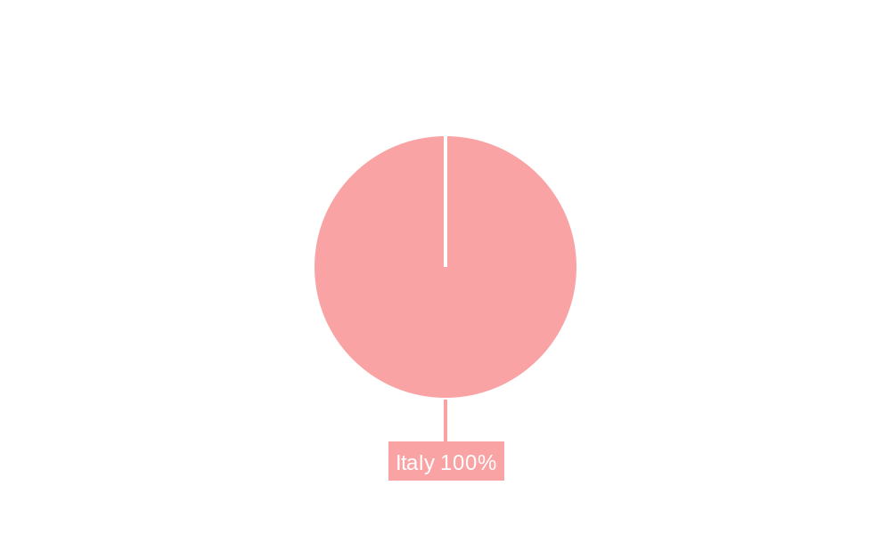
Italy Satellite Imagery Services Market Segmentation By Geography
- 1. Italy
Italy Satellite Imagery Services Market Regional Market Share
Geographic Coverage of Italy Satellite Imagery Services Market
Italy Satellite Imagery Services Market REPORT HIGHLIGHTS
| Aspects | Details |
|---|---|
| Study Period | 2020-2034 |
| Base Year | 2025 |
| Estimated Year | 2026 |
| Forecast Period | 2026-2034 |
| Historical Period | 2020-2025 |
| Growth Rate | CAGR of 10% from 2020-2034 |
| Segmentation |
|
Table of Contents
- 1. Introduction
- 1.1. Research Scope
- 1.2. Market Segmentation
- 1.3. Research Objective
- 1.4. Definitions and Assumptions
- 2. Executive Summary
- 2.1. Market Snapshot
- 3. Market Dynamics
- 3.1. Market Drivers
- 3.2. Market Restrains
- 3.3. Market Trends
- 3.4. Market Opportunities
- 4. Market Factor Analysis
- 4.1. Porters Five Forces
- 4.1.1. Bargaining Power of Suppliers
- 4.1.2. Bargaining Power of Buyers
- 4.1.3. Threat of New Entrants
- 4.1.4. Threat of Substitutes
- 4.1.5. Competitive Rivalry
- 4.2. PESTEL analysis
- 4.3. BCG Analysis
- 4.3.1. Stars (High Growth, High Market Share)
- 4.3.2. Cash Cows (Low Growth, High Market Share)
- 4.3.3. Question Mark (High Growth, Low Market Share)
- 4.3.4. Dogs (Low Growth, Low Market Share)
- 4.4. Ansoff Matrix Analysis
- 4.5. Supply Chain Analysis
- 4.6. Regulatory Landscape
- 4.7. Current Market Potential and Opportunity Assessment (TAM–SAM–SOM Framework)
- 4.8. TIR Analyst Note
- 4.1. Porters Five Forces
- 5. Market Analysis, Insights and Forecast 2021-2033
- 5.1. Market Analysis, Insights and Forecast - by Application
- 5.1.1. Geospatial Data Acquisition and Mapping
- 5.1.2. Natural Resource Management
- 5.1.3. Surveillance and Security
- 5.1.4. Conservation and Research
- 5.1.5. Disaster Management
- 5.1.6. Intelligence
- 5.2. Market Analysis, Insights and Forecast - by End-User
- 5.2.1. Government
- 5.2.2. Construction
- 5.2.3. Transportation and Logistics
- 5.2.4. Military and Defense
- 5.2.5. Forestry and Agriculture
- 5.2.6. Others
- 5.3. Market Analysis, Insights and Forecast - by Region
- 5.3.1. Italy
- 5.1. Market Analysis, Insights and Forecast - by Application
- 6. Italy Satellite Imagery Services Market Analysis, Insights and Forecast, 2021-2033
- 6.1. Market Analysis, Insights and Forecast - by Application
- 6.1.1. Geospatial Data Acquisition and Mapping
- 6.1.2. Natural Resource Management
- 6.1.3. Surveillance and Security
- 6.1.4. Conservation and Research
- 6.1.5. Disaster Management
- 6.1.6. Intelligence
- 6.2. Market Analysis, Insights and Forecast - by End-User
- 6.2.1. Government
- 6.2.2. Construction
- 6.2.3. Transportation and Logistics
- 6.2.4. Military and Defense
- 6.2.5. Forestry and Agriculture
- 6.2.6. Others
- 6.1. Market Analysis, Insights and Forecast - by Application
- 7. Competitive Analysis
- 7.1. Company Profiles
- 7.1.1 e-GEOS
- 7.1.1.1. Company Overview
- 7.1.1.2. Products
- 7.1.1.3. Company Financials
- 7.1.1.4. SWOT Analysis
- 7.1.2 Geocento
- 7.1.2.1. Company Overview
- 7.1.2.2. Products
- 7.1.2.3. Company Financials
- 7.1.2.4. SWOT Analysis
- 7.1.3 Airbus
- 7.1.3.1. Company Overview
- 7.1.3.2. Products
- 7.1.3.3. Company Financials
- 7.1.3.4. SWOT Analysis
- 7.1.4 Planetek Italia s r l
- 7.1.4.1. Company Overview
- 7.1.4.2. Products
- 7.1.4.3. Company Financials
- 7.1.4.4. SWOT Analysis
- 7.1.5 Maxar Technologies
- 7.1.5.1. Company Overview
- 7.1.5.2. Products
- 7.1.5.3. Company Financials
- 7.1.5.4. SWOT Analysis
- 7.1.6 L3Harris Technologies*List Not Exhaustive
- 7.1.6.1. Company Overview
- 7.1.6.2. Products
- 7.1.6.3. Company Financials
- 7.1.6.4. SWOT Analysis
- 7.1.7 Viasat Group S p A
- 7.1.7.1. Company Overview
- 7.1.7.2. Products
- 7.1.7.3. Company Financials
- 7.1.7.4. SWOT Analysis
- 7.1.8 EUSI
- 7.1.8.1. Company Overview
- 7.1.8.2. Products
- 7.1.8.3. Company Financials
- 7.1.8.4. SWOT Analysis
- 7.1.9 Thales Alenia Space
- 7.1.9.1. Company Overview
- 7.1.9.2. Products
- 7.1.9.3. Company Financials
- 7.1.9.4. SWOT Analysis
- 7.1.10 OHB-Italia S p A
- 7.1.10.1. Company Overview
- 7.1.10.2. Products
- 7.1.10.3. Company Financials
- 7.1.10.4. SWOT Analysis
- 7.1.1 e-GEOS
- 7.2. Market Entropy
- 7.2.1 Company's Key Areas Served
- 7.2.2 Recent Developments
- 7.3. Company Market Share Analysis 2025
- 7.3.1 Top 5 Companies Market Share Analysis
- 7.3.2 Top 3 Companies Market Share Analysis
- 7.4. List of Potential Customers
- 8. Research Methodology
List of Figures
- Figure 1: Italy Satellite Imagery Services Market Revenue Breakdown (billion, %) by Product 2025 & 2033
- Figure 2: Italy Satellite Imagery Services Market Share (%) by Company 2025
List of Tables
- Table 1: Italy Satellite Imagery Services Market Revenue billion Forecast, by Application 2020 & 2033
- Table 2: Italy Satellite Imagery Services Market Revenue billion Forecast, by End-User 2020 & 2033
- Table 3: Italy Satellite Imagery Services Market Revenue billion Forecast, by Region 2020 & 2033
- Table 4: Italy Satellite Imagery Services Market Revenue billion Forecast, by Application 2020 & 2033
- Table 5: Italy Satellite Imagery Services Market Revenue billion Forecast, by End-User 2020 & 2033
- Table 6: Italy Satellite Imagery Services Market Revenue billion Forecast, by Country 2020 & 2033
Frequently Asked Questions
1. What is the projected Compound Annual Growth Rate (CAGR) of the Italy Satellite Imagery Services Market?
The projected CAGR is approximately 10%.
2. Which companies are prominent players in the Italy Satellite Imagery Services Market?
Key companies in the market include e-GEOS, Geocento, Airbus, Planetek Italia s r l, Maxar Technologies, L3Harris Technologies*List Not Exhaustive, Viasat Group S p A, EUSI, Thales Alenia Space, OHB-Italia S p A.
3. What are the main segments of the Italy Satellite Imagery Services Market?
The market segments include Application, End-User.
4. Can you provide details about the market size?
The market size is estimated to be USD 2.83 billion as of 2022.
5. What are some drivers contributing to market growth?
Increasing Investments to Strengthen Country's Space Economy; Adoption of Big Data and Imagery Analytics.
6. What are the notable trends driving market growth?
Disaster Management Segment is Expected to Hold Significant Market Share.
7. Are there any restraints impacting market growth?
High Cost of Satellite Imaging Data Acquisition and Processing.
8. Can you provide examples of recent developments in the market?
March 2023: Arianespace announced signing a contract with the European Space Agency (ESA), acting on behalf of the Italian government, for launching the IRIDE constellation of imaging satellites. The agreement includes two firm Vega C launches, starting in late 2025, with an option for a third. The Italian government funds the IRIDE constellation. It will consist of 36 satellites built by a consortium of Italian companies equipped with various imaging payloads, including optical and radar.
9. What pricing options are available for accessing the report?
Pricing options include single-user, multi-user, and enterprise licenses priced at USD 3800, USD 4500, and USD 5800 respectively.
10. Is the market size provided in terms of value or volume?
The market size is provided in terms of value, measured in billion.
11. Are there any specific market keywords associated with the report?
Yes, the market keyword associated with the report is "Italy Satellite Imagery Services Market," which aids in identifying and referencing the specific market segment covered.
12. How do I determine which pricing option suits my needs best?
The pricing options vary based on user requirements and access needs. Individual users may opt for single-user licenses, while businesses requiring broader access may choose multi-user or enterprise licenses for cost-effective access to the report.
13. Are there any additional resources or data provided in the Italy Satellite Imagery Services Market report?
While the report offers comprehensive insights, it's advisable to review the specific contents or supplementary materials provided to ascertain if additional resources or data are available.
14. How can I stay updated on further developments or reports in the Italy Satellite Imagery Services Market?
To stay informed about further developments, trends, and reports in the Italy Satellite Imagery Services Market, consider subscribing to industry newsletters, following relevant companies and organizations, or regularly checking reputable industry news sources and publications.
Methodology
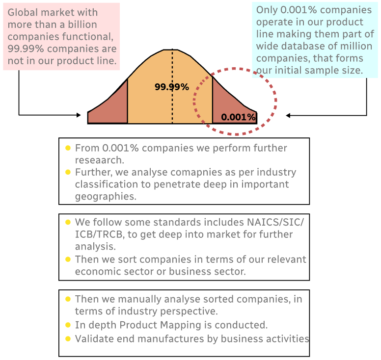
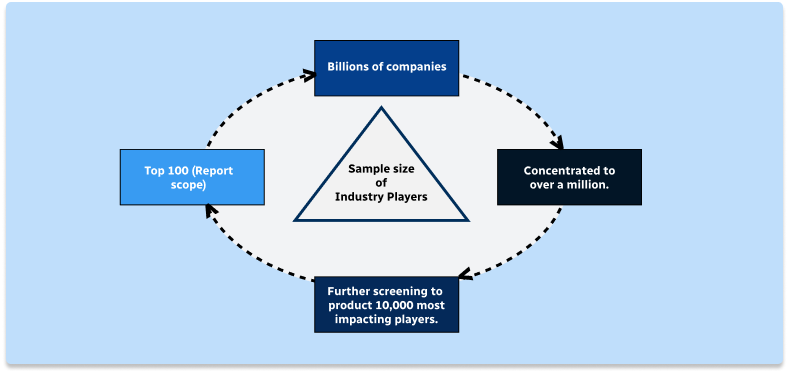
Step 1 - Identification of Relevant Samples Size from Population Database
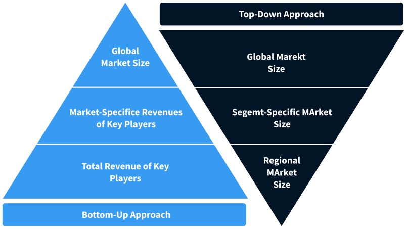
Step 2 - Approaches for Defining Global Market Size (Value, Volume* & Price*)
Note*: In applicable scenarios
Step 3 - Data Sources
Primary Research
- Web Analytics
- Survey Reports
- Research Institute
- Latest Research Reports
- Opinion Leaders
Secondary Research
- Annual Reports
- White Paper
- Latest Press Release
- Industry Association
- Paid Database
- Investor Presentations
Step 4 - Data Triangulation
Involves using different sources of information in order to increase the validity of a study
These sources are likely to be stakeholders in a program - participants, other researchers, program staff, other community members, and so on.
Then we put all data in single framework & apply various statistical tools to find out the dynamic on the market.
During the analysis stage, feedback from the stakeholder groups would be compared to determine areas of agreement as well as areas of divergence